


Voting District 0218083, Nassau County, New York
About
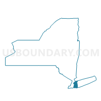
Outline

Summary
| Unique Area Identifier | 631301 |
| Name | Voting District 0218083 |
| County | Nassau County |
| State | New York |
| Area (square miles) | 43.33 |
| Land Area (square miles) | 11.24 |
| Water Area (square miles) | 32.09 |
| % of Land Area | 25.93 |
| % of Water Area | 74.07 |
| Latitude of the Internal Point | 40.58952710 |
| Longtitude of the Internal Point | -73.53819480 |
Maps


Graphs
Select a template below for downloading or customizing gragh for Voting District 0218083, Nassau County, New York


Neighbors
Neighoring Voting District (by Name) Neighboring Voting District on the Map
- Voting District 0218034, Nassau County, NY
- Voting District 0218071, Nassau County, NY
- Voting District 0218084, Nassau County, NY
- Voting District 0219004 0219097, Nassau County, NY
- Voting District 0219039, Nassau County, NY
- Voting District 0219044, Nassau County, NY
- Voting District 0219046, Nassau County, NY
- Voting District 0219049, Nassau County, NY
- Voting District 0219055 0219058 0219059, Nassau County, NY
- Voting District 0219063, Nassau County, NY
- Voting District 0219065, Nassau County, NY
- Voting District 0219066, Nassau County, NY
- Voting District 0219067, Nassau County, NY
- Voting District 0219068, Nassau County, NY
- Voting District 0219074 0219078, Nassau County, NY
- Voting District 0219084, Nassau County, NY
- Voting District 0219085, Nassau County, NY
- Voting District 0219096, Nassau County, NY
- Voting District 0219108, Nassau County, NY
- Voting District 0220016, Nassau County, NY
- Voting District 0220041, Nassau County, NY
- Voting District 0220044, Nassau County, NY
- Voting District 0220066 0220067, Nassau County, NY
- Voting District 0220068, Nassau County, NY
- Voting District 0220078, Nassau County, NY
- Voting District 0320011, Nassau County, NY
- Voting District 0320018, Nassau County, NY
- Voting District 0512067, Nassau County, NY
Top 10 Neighboring County Subdivision (by Population) Neighboring County Subdivision on the Map
- Hempstead town, Nassau County, NY (759,757)
- Oyster Bay town, Nassau County, NY (293,214)
- Long Beach city, Nassau County, NY (33,275)
Top 10 Neighboring Place (by Population) Neighboring Place on the Map
- Freeport village, NY (42,860)
- Long Beach city, NY (33,275)
- Oceanside CDP, NY (32,109)
- Merrick CDP, NY (22,097)
- Massapequa CDP, NY (21,685)
- Wantagh CDP, NY (18,871)
- Bellmore CDP, NY (16,218)
- Seaford CDP, NY (15,294)
- Baldwin Harbor CDP, NY (8,102)
- Lido Beach CDP, NY (2,897)
Top 10 Neighboring Elementary School District (by Population) Neighboring Elementary School District on the Map
Top 10 Neighboring Secondary School District (by Population) Neighboring Secondary School District on the Map
Top 10 Neighboring Unified School District (by Population) Neighboring Unified School District on the Map
- Freeport Union Free School District, NY (39,967)
- Long Beach City School District, NY (38,655)
- Oceanside Union Free School District, NY (36,847)
- Baldwin Union Free School District, NY (32,837)
- Wantagh Union Free School District, NY (17,808)
- Seaford Union Free School District, NY (16,242)
- Island Park Union Free School District, NY (8,370)
Top 10 Neighboring State Legislative District Lower Chamber (by Population) Neighboring State Legislative District Lower Chamber on the Map
- Assembly District 18, NY (130,690)
- Assembly District 19, NY (128,933)
- Assembly District 20, NY (128,831)
- Assembly District 12, NY (126,438)
Top 10 Neighboring State Legislative District Upper Chamber (by Population) Neighboring State Legislative District Upper Chamber on the Map
Top 10 Neighboring 111th Congressional District (by Population) Neighboring 111th Congressional District on the Map
Top 10 Neighboring Census Tract (by Population) Neighboring Census Tract on the Map
- Census Tract 4161, Nassau County, NY (6,492)
- Census Tract 4157, Nassau County, NY (6,091)
- Census Tract 4134, Nassau County, NY (5,702)
- Census Tract 5213.02, Nassau County, NY (5,527)
- Census Tract 4145.01, Nassau County, NY (5,439)
- Census Tract 4144, Nassau County, NY (5,239)
- Census Tract 4151.02, Nassau County, NY (5,159)
- Census Tract 4154.02, Nassau County, NY (4,797)
- Census Tract 5219.02, Nassau County, NY (4,559)
- Census Tract 4152.02, Nassau County, NY (4,428)
Top 10 Neighboring 5-Digit ZIP Code Tabulation Area (by Population) Neighboring 5-Digit ZIP Code Tabulation Area on the Map
- 11758, NY (53,804)
- 11520, NY (43,341)
- 11561, NY (37,280)
- 11566, NY (35,321)
- 11710, NY (34,496)
- 11510, NY (33,048)
- 11793, NY (32,298)
- 11572, NY (30,574)
- 11783, NY (21,288)
- 11558, NY (8,370)